データを使用した場合の引用について
- (1)本データを使用した場合,その成果物には必ず下記を引用して下さい.
- Iwasaki, T., Sato, H., Shinohara, M., Ishiyama, T. & Hashima, A., 2015.Fundamental structure model of island arcs and subducted plates in and around Japan, 2015 Fall Meeting, American Geophysical Union, San Francisco, Dec. 14-18, T31B-2878.
- Lindquist, K. G., K. Engle, D. Stahlke, and E. Price (2004), Global Topography and Bathymetry Grid Improves Research Efforts, Eos Trans. AGU, 85(19), 186. http://onlinelibrary.wiley.com/doi/10.1029/2004EO190003/abstract
- (2)更に,Acknowledgementに,以下を記述して,データの出処を明示して下さい.
本研究で用いたプレート境界モデル(Iwasaki et al., 2015)は,国土地理院の”数値地図250mメッシュ(標高)”,日本海洋データセンターによる500mメッシュ海底地形データ(J-EGG500, http://www.jodc.go.jp/data_set/jodc/jegg_intro_j.html)及びGeographic Information Network of Alaska(アラスカ大学)の地形・水深データ((Lindquist et al., 2004)から作成したものである.
- 英文の場合
- The plate models by Iwasaki et al. (2015) were constructed from topography and bathymetry data by Geospatial Information Authority of Japan (250-m digital map), Japan Oceanographic Data Center (500m mesh bathemetry data, J-EGG500, http://www.jodc.go.jp/jodcweb/JDOSS/infoJEGG_j.html) and Geographic Information Network of Alaska,University of Alaska (Lindquist et al., 2004).
- Iwasaki, T., Sato, H., Shinohara, M., Ishiyama, T. & Hashima, A., 2015.Fundamental structure model of island arcs and subducted plates in and around Japan, 2015 Fall Meeting, American Geophysical Union, San Francisco, Dec. 14-18, T31B-2878.
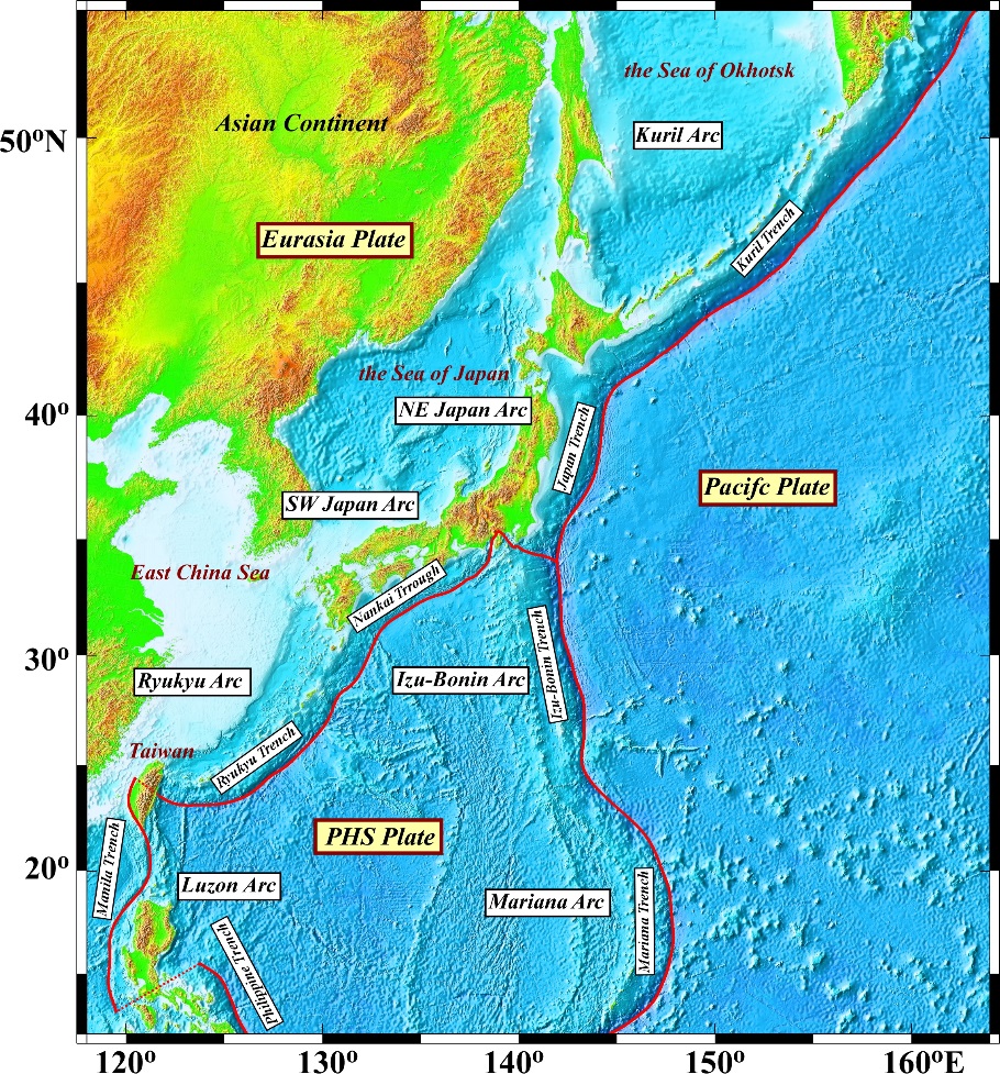
Fig.1 Topography and trench-axis models.